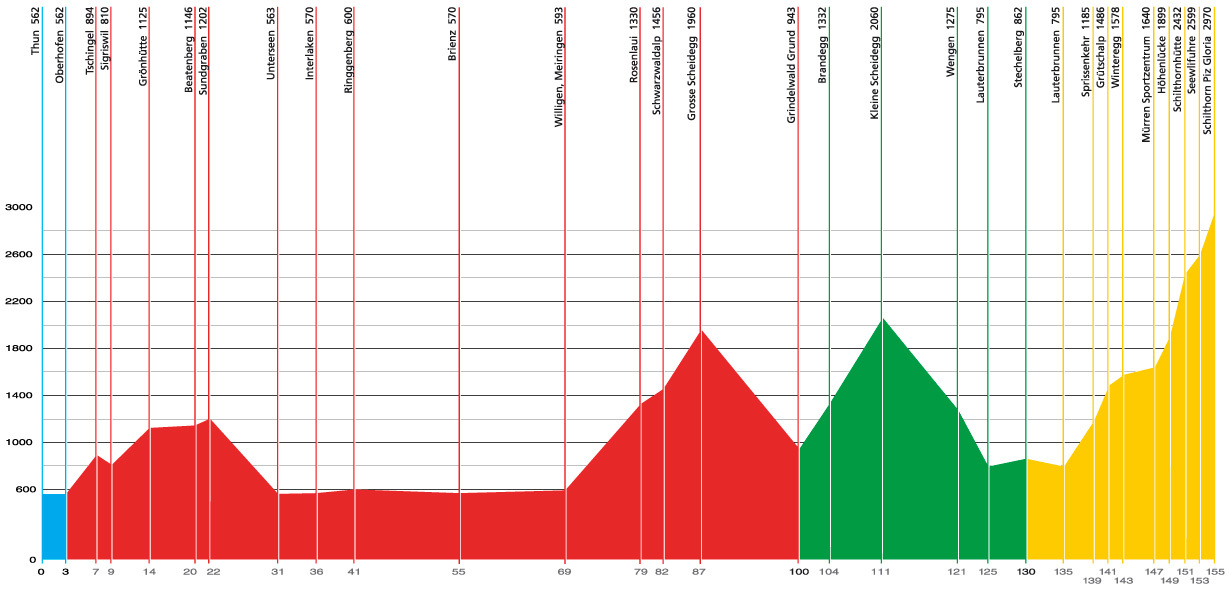
Everything around the route from Thun to the Schilthorn.
Distance: 3.1 km
Thun - Oberhofen
Distance: 97 km
Inclination: 2145 m
Oberhofen (562 a.s.l.)
Sigriswil (810 a.s.l.)
Beatenberg (1215 a.s.l.)
Interlaken (568 a.s.l.)
Meiringen (593 a.s.l.)
Grosse Scheidegg (1962 a.s.l.)
Grindelwald (943 a.s.l.)
Distance: 30 km
Inclination: 1180 m
Grindelwald (943 a.s.l.)
Kleine Scheidegg (2061 a.s.l.)
Wengen (1275 a.s.l.)
Lauterbrunnen (795 a.s.l.)
Stechelberg (862 a.s.l.)
Distance: 25 km
Inclination: 2175 m
Stechelberg (862 a.s.l.)
Lauterbrunnen (795 a.s.l.)
Mürren (1640 a.s.l.)
Schilthorn (2970 a.s.l.)
Distance: 17 km
Inlication: 850 m
Stechelberg (862 a.s.l.)
Lauterbrunnen (795 a.s.l.)
Mürren (1640 a.s.l.)